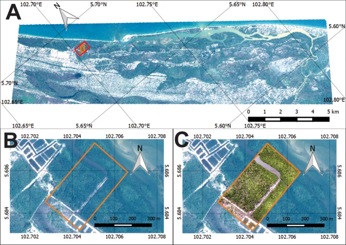
Fig 1. Research area in Setiu Wetland.
(A) Setiu Wetland as shown by Pleiades-1B satellite imagery (acquired on 16 August 2013 at 11.43 AM). Red box indicates the location of mangroves being considered for vegetation mapping in the present study. (B) Pan-sharpened Pleiades-1B imagery (spatial resolution: 50cm) showing the zoomed-in portion of the mangroves selected for mapping (orange box). (C) DJI-Phantom-2 drone imagery (acquired on 3 July 2015 at 10.00AM) (spatial resolution: 5 cm) showingthe same mangrove coverage area as that of Pleiades for mapping (orange box) (background: Pleiades imagery).

