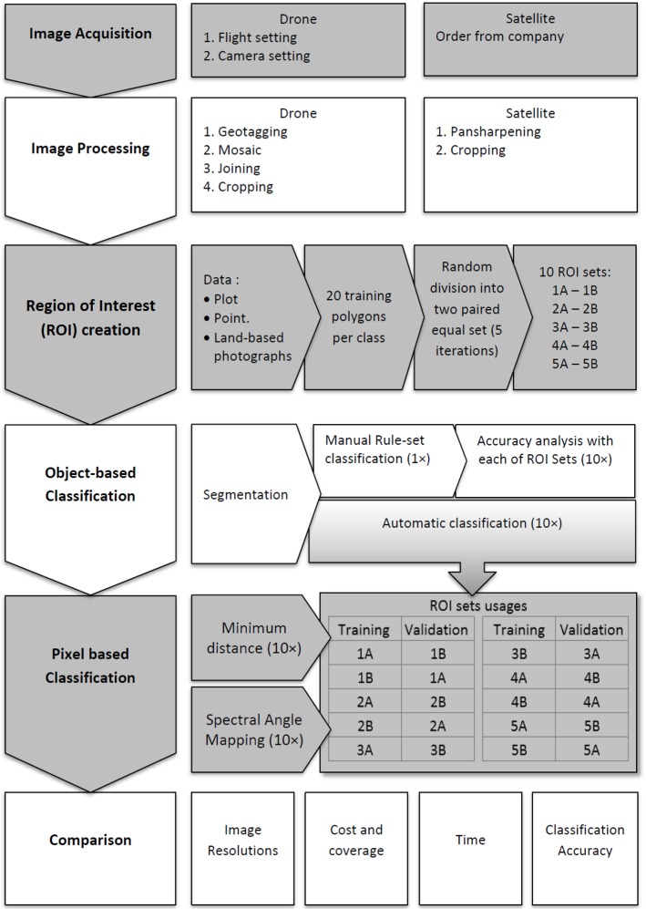
Fig 2. Stepwise protocol and the technical processes involved in drone and satellite remote sensing data analyses for mangrove mapping at the Setiu Wetland.
The 10 ROI sets were named 1A-1B to 5A-5B. Except the manual rule-set algorithm, the remaining algorithms i.e., automatic, maximum likelihood and spectral angle mapping, were used 10 times (10×) for running the object- and pixel-based classification approaches (grey and white shades are for visualization purposes).

