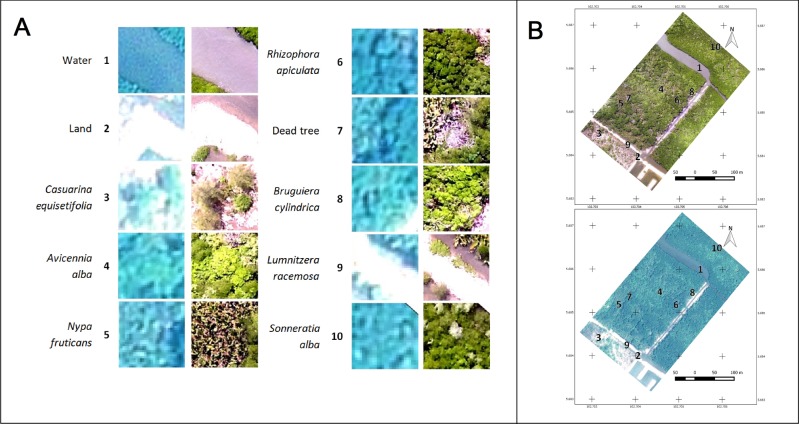
Fig 5. Land-cover classes at the Setiu Wetland.
(A) Land-cover classes based on Pleiades-1B satellite (on the left) and DJI-Phantom-2 drone (on the right). Due to the poor demarcation of some features in the Pleiades, only 1–6 land-cover classes were considered for its image classification. (B) Locations of the ten (1–10) land-use/cover classes marked on the Pleiades-1B (top) and DJI-Phantom-2 drone (bottom) images.

