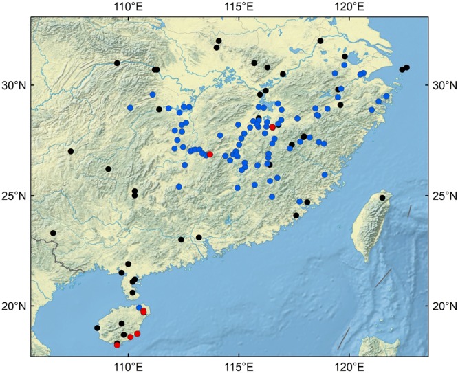
Figure 1.

Geographic locations of samples. Red dots represent soil samples from wild rice fields; blue dots represent soil samples from domesticated rice paddies; black dots represent soil samples from non-rice fields. (The figure was generated using GRASS GIS 7.2.1: GRASS Development Team, 2017. Geographic Resources Analysis Support System (GRASS) Software, Version 7.2. Open Source Geospatial Foundation. Electronic document: http://grass.osgeo.org).
