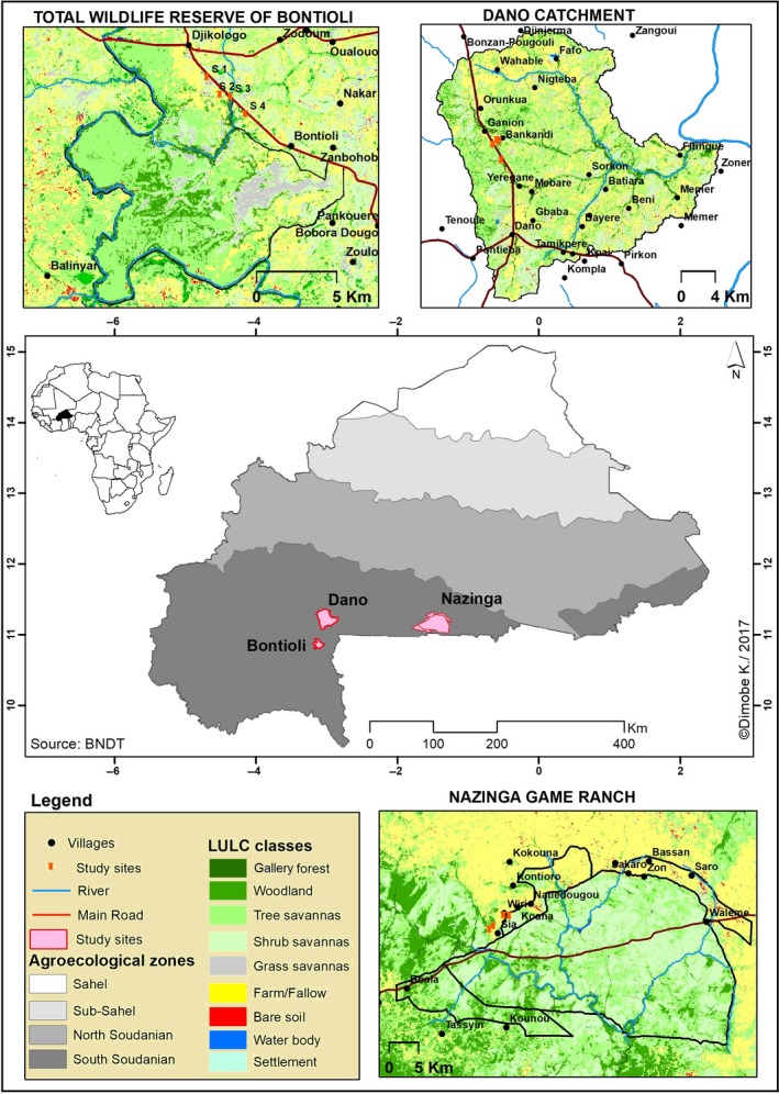
Figure 1.

Map with land‐use and land cover data of the three study areas Nazinga (low disturbance intensity; DI), Bontioli (medium DI), and Dano (high DI) in 2014 and their location within Burkina Faso

Map with land‐use and land cover data of the three study areas Nazinga (low disturbance intensity; DI), Bontioli (medium DI), and Dano (high DI) in 2014 and their location within Burkina Faso