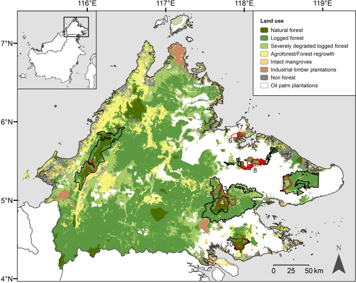
Fig 1. The locations of the eight forest and two oil palm plantation study areas in Sabah, Malaysian Borneo.
Numbered polygons represent the different study areas, defined by the locations of the outermost camera stations: 1. Crocker Range Park; 2. Malua Forest Reserve; 3. Danum Palm Plantation; 4. Danum Valley Conservation Area (surveyed on two separate occasions); 5. Ulu Segama Forest Reserve; 6. Minat Teguh plantation; 7. Kabili-Sepilok Forest Reserve; 8. Lower Kinabatangan Wildlife Sanctuary; 9. Tabin Wildlife Reserve; 10. Tawau Hills Park (surveyed on two separate occasions). Inset shows the island of Borneo. Land use data from 2010 [36].

