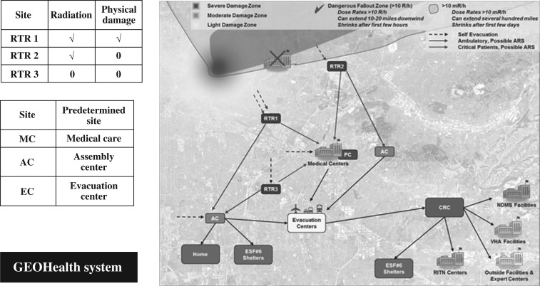
Figure 1.
The RTR system and medical response, GIS systems approach. The response to a nuclear or large radiological disaster requires accounting for the physical destruction and the presence of radiation. The damage zones include severe, moderate and light damage, dangerous fallout zones and a zone where time in the zone is monitored. The RTR system(10) includes sites that will form and be determined spontaneously, RTR1, 2 and 3, and others that are predetermined sites (e.g. assembly centres, medical centres [Veterans Administration (VA), National Disaster Medical System (NDMS) and RITN], evacuation centres, community reception centres (CRCs), and Emergency Support Function (ESF) shelters). The coordination of information is accomplished using GeoHEALTH, which is the GIS approach developed by ASPR(12). (Figure reproduced with permission from Hrdrina et al.(10))

