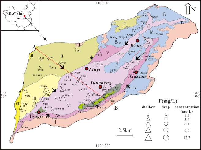
Fig 1. Simple geomorphological map of the Yuncheng Basin, China.
(Areas: I, mountain bedrock areas; II, Emei high platform; III, Kaolao low platform; IV, loess hilly regions; V, piedmont plain; VI, alluvial plain; VII, fluvial depressions; VIII, Yellow River terrace). → groundwater flow direction; pentagram, surface water; triangle, shallow groundwater; circle, deep groundwater; Line AB, location of cross-section in Fig 2.

