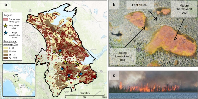
Fig. 1.
Wildfire in western Canadian peatlands. a Outline of the study region, defined as the discontinuous and sporadic permafrost zones56 within the Taiga Plains ecozone59. Shading shows coverage of peat plateaus as indicated by the distribution of histel soils58. Historical burned areas from the last 30 years are shown as hashed areas57. Yellow stars indicate locations where soil thermal regime was monitored, with one unburned and at least one burned site at each star location. Blue stars indicate locations where satellite image classification of young thermokarst bog extents were assessed within large peatlands partially affected by wildfire. b Example of a peatland characteristic for the study region, with three non-treed thermokarst bogs without permafrost surrounded by treed permafrost peat plateau. Distinct young thermokarst bog stages are visible as green areas along some peat plateau edges, resulting from recent permafrost thaw. Photo copyright Mason Stothart. c Example of a characteristic crown fire burning a peat plateau, near Fort Simpson, NWT, in 2014. Photo copyright Franco Alo

