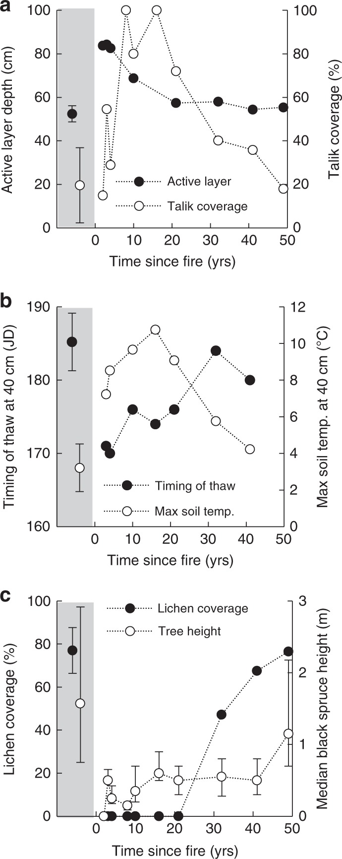
Fig. 3.

Trajectories of soil thermal regime and vegetation reestablishment on peat plateaus following wildfire. a Active layer depth (cm), and talik coverage (%). Taliks are continuously thawed soil layers between the permafrost and the seasonally frozen soil. No active layer estimates were possible for sites burned 7 and 16 years ago due to complete talik coverage. b Timing of thaw at 40 cm depth (Julian Date, JD), as indicated by timing of the first exceedance of 0.5 °C soil temperature, and the maximum annual soil temperature (°C) at 40 cm. Soil temperature loggers malfunctions at sites burned 7 and 49 years ago, and is missing. c Trajectories of vegetation reestablishment, including ground cover of lichens (%), and median height of black spruce trees (m), where error bars indicate interquartile range. In each panel, the average of 6 unburned sites is shown on the left with gray background, where error bars indicate ±1 standard deviation
