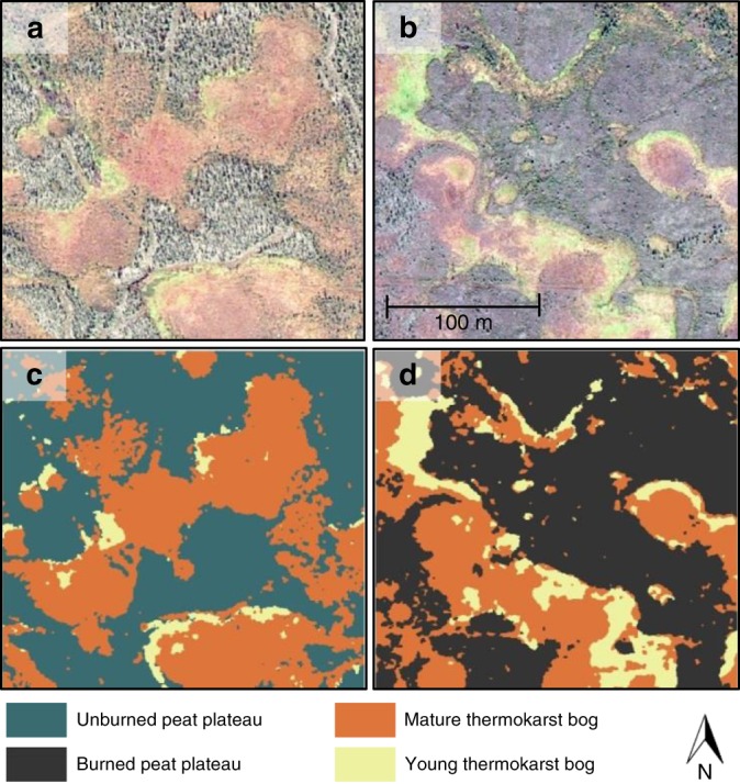
Fig. 4.

Classification of peat plateau, young thermokarst bog, and mature thermokarst bog using high resolution satellite imagery in peatlands partially affected by historical wildfires. a and b Examples of satellite imagery (WorldView-2, 0.6 m resolution) for 250 × 250 m sections within unburned and burned peatland parts, respectively. Satellite images were acquired in 2011, the burn occurred in 1987. c and d Examples of supervised classification of the unburned and burned sections, respectively
