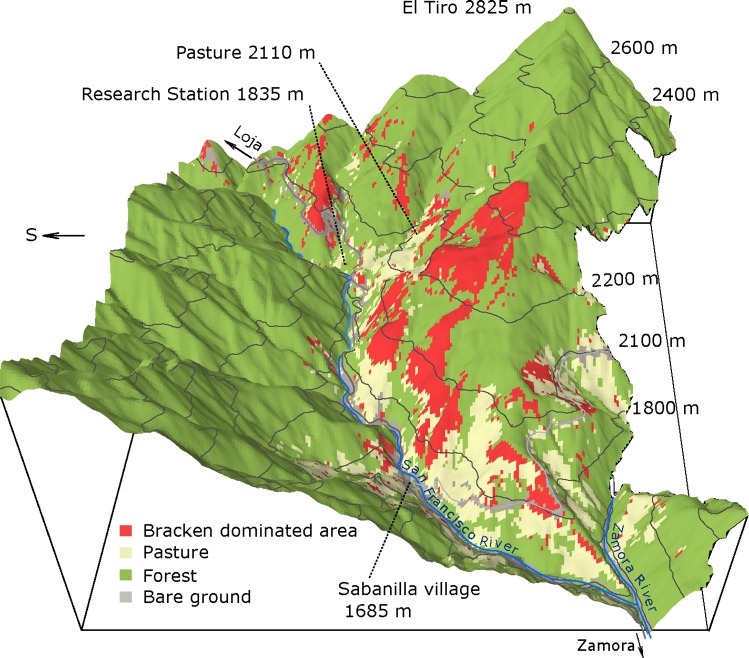
Fig 1. Invasion of Bracken into pastures as dependent upon elevation.
A digital elevation model derived by airborne laser scanning is overlaid by the land-cover classification based on multispectral satellite data generated by Quickbird in November 2010 of the research area in the San Francisco valley in South Ecuador (from 1000 m to 2800 m elevation). The occurrence of Bracken, as detected by multispectral remote sensing, is shown in red, while pastures are in cream color. Study locations are labeled accordingly, and the elevation is given in m a.s.l.. The dominant grass on the pastures is Setaria.

