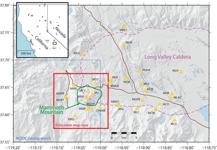
Fig. 4. Map of local permanent seismic network of Mammoth Mountain and nearby Long Valley Caldera.

Temporary stations are not shown. The dotted blue box shows the extent of the original NCEDC earthquake catalog search, and the red box corresponds to the map view shown in Fig. 1. The inset map also shows two distant stations used in focal mechanism determination.
