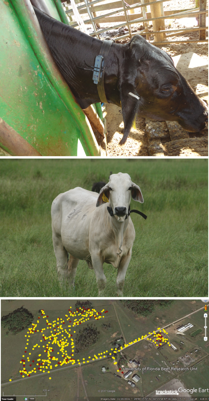
Figure 2.
Tracking of location of individual cows using a global positioning system device. The top panel is a photograph of the placement of the device on a collar around the neck of the animal, and the middle panel shows a cow wearing a collar during the experiment. The bottom panel is an example of positional information (yellow circles indicate the cow was moving and red circles indicate the cow was stationery) mapped using Google MapLink. Data were recorded each time the device changes course or becomes stationery. At each position, data were collected for latitude, longitude, altitude, coordinates for mapping location on Google MapLink, dry-bulb temperature, and whether the device was moving or stationery. When moving, the direction and speed of movement was recorded. The device also recorded the duration of stationery periods.

