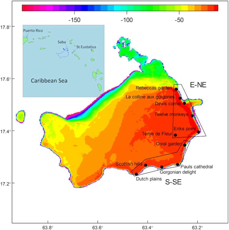
Figure 1. Map of the Saba Bank with inset.
Map of the Saba Bank with depth contours (color scale in meter) and stations which were visited in October 2011 and October 2013. Fore-reef stations were in the 17–32 m depth range and the patch reef on top of the Saba Bank, Tertre de Fleur, was at 15 m depth. Stations Dutch plains until Coral garden were exposed to the S-SE and the rest of the stations had an E-NE exposition. Inset shows the position of the Saba Bank in the Caribbean Sea, with nearest islands Saba (∼5 km NE of the Saba Bank) and St. Eustatius (∼20 km East of the Saba Bank).

