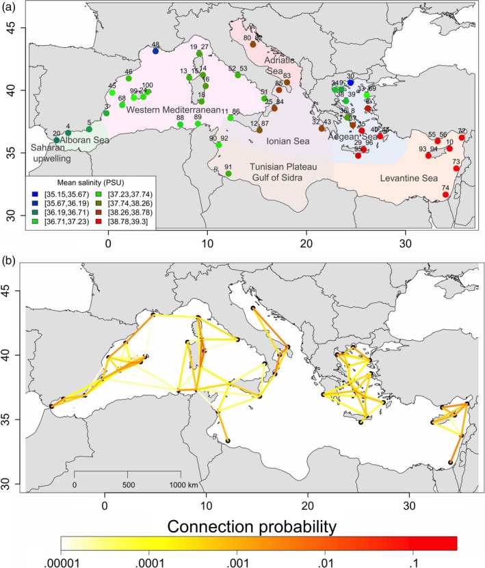
Figure 2.

Maps of sampling and larval dispersal of Mullus surmuletus. (a) Map of the Mediterranean basin showing the location of the 47 sampling sites in the eight marine ecoregions of the world: Adriatic Sea (red; two sites), Aegean Sea (blue; 12 sites), Alboran Sea (green; three sites), Ionian Sea (purple; five sites), Levantine Sea (orange; six sites), Saharan Upwelling (yellow; one site), Tunisian Plateau/Gulf of Sidra (brown; two sites), and western Mediterranean (pink; 16 sites). The color gradient indicates the mean sea surface salinity at each site. (b) Map of the pairwise probabilities of receiving larvae between sites. The color gradient indicates the larval dispersal probabilities between pairs of sites. Although larval dispersal between two sites is directional, for simplicity only the stronger connection probability is represented in this figure (i.e., the fraction of larvae originating in MPA j that ended up in MPA i). The larval dispersal probabilities identify three isolated groups
