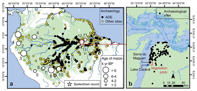
Figure 1. Regional Study Area .
a. Map showing Amazonian pollen, archaeological site 93,94 and records documenting early presence of maize: 1. Lake San Pablo, 2. Lake Ayauch, 3. Lake Sauce, 4. Abeja, 5. Huaypo, 6. Puerto Maldonado, 7. Lake Gentry, 8. Lake Rogaguado, 9. Parmana, 10. Monte Castelo, 11. Geral, 12. Lake Caranã (Supplementary Table S1). 13. Location of Paraíso Cave speleothem record (indicated by star). b. Santarém region showing location of Lake Caranã and the Serra do Maguari archaeological site 50.

