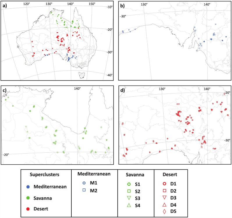
Fig 1. Geographical location of survey plots.
(a) All sampled AusPlots grouped into superclusters. (b) Plots from clusters M1- M2 within the Mediterranean supercluster. (c) Plots from clusters S1–S4 within the savanna supercluster. (d) Plots from clusters D1- D5 within the desert supercluster. Letterings in the map refer to approximate position of places cited in the text. Flinders Lofty Block (FLB); Gibson Desert (GB); Great Australian Bight (GAB); Great Victoria Desert (GVD); Gulf of Carpentaria (GC); Longreach (L); Mitchell Grass Downs (MGD); North Eastern South Australia (NESA). Figure is for reference only as it not possible to discriminate plots due to the small scale of the maps. All AusPlots are fully represented in S1 Table.

