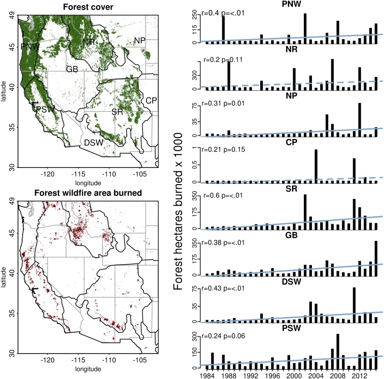
Fig. 1.
Forest cover and forest wildfire area burned from 1984 to 2015 in the western United States with eight NEON domains outlined in black. (Right) Total annual forested hectares burned within each NEON domain. Blue lines show the linear trend in area burned, with a solid line indicating a statistically significant trend at P < 0.10. CP, Central Plains; DSW, Desert Southwest; GB, Great Basin; NP, Northern Plains; NR, Northern Rockies; PNW, Pacific Northwest; PSW, Pacific Southwest; SR, Southern Rockies.

