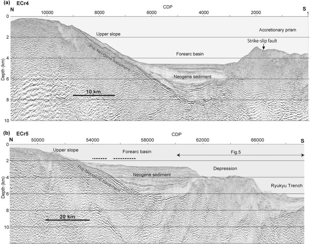
Figure 2.
Seismic profiles of forearc slopes seaward of the Sakishima Islands. (a) Seismic profile of ECr4, which shows the topographic high bounding the seaward margin of the accretionary prism. (b) Seismic profile of ECr5, in which the seaward topographic high is absent. Approximate locations of the fault models23,25 for the 1771 tsunami source are shown by dashed lines above the forearc basin. Locations of the profiles are shown in Fig. 1. The image was produced using SPW 2.2 [http://www.parallelgeo.com/] and Adobe Illustrator CS6.

