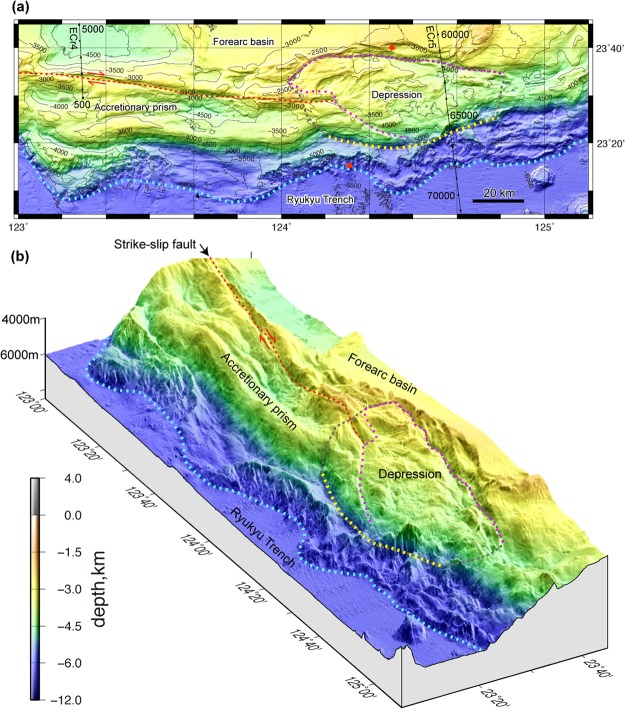
Figure 3.
Detailed topography of the accretionary prism south of the Sakishima Islands. (a) Plain map and (b) bird’s-eye view of the accretionary prism show two major ridges and a strike-slip fault (orange dotted line) west of 124°E and a depression east of 124°E (pink dotted line). The seaward bulge and deformation front are indicated by yellow and sky blue dotted lines. The inferred slide mass is outlined by the grey dotted line. Dive survey sites36 where slope failures were observed are indicated by red circles. The map area is shown in Fig. 1b. The images were produced using GMT 4.546 and Adobe Illustrator CS6.

