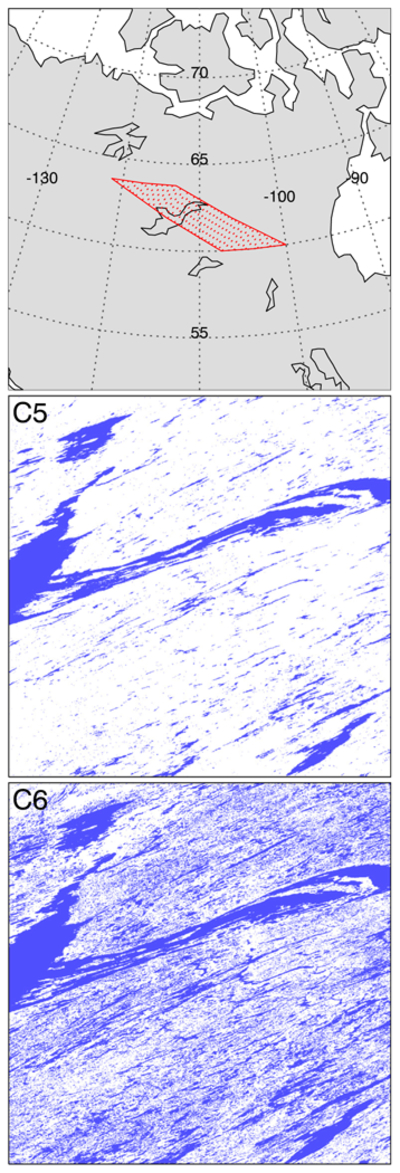
Fig. 4.

Example of MODIS Collection 5 and also Collection 5.1 (middle panel) and Collection 6 (bottom panel) MODIS land/water mask for a spatial subset of MODIS tile h12v02 (top panel, red outline) encompassing the western half of the Great Slave Lake in Northwest Territories, Canada. In this particular ex-ample, the increase in the number of small water bodies (shown in blue) mapped in Collection 6 is striking. The region shown in the lower two panels is approximately 830 km × 830 km in size. (For interpretation of the references to color in this figure legend, the reader is referred to the web version of this article.)
