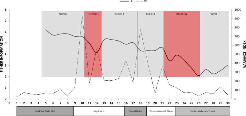
Figure 2.
Fisher information ((FI; bold solid line)) and Variance Index (VI; faint dotted line) for Breeding Bird Survey community data from 30 routes (numbered from 1 to 30 on the x-axis, reflecting the west to east ordering of the routes in geographic space). Regimes identified by FI are shown as shaded boxes around the plotted line. The Omernik ecoregion domains under the x-axis allow comparison as to how well the regimes align with the ecoregions, which represent potential rather than actual vegetation. Because one FI value is produced per window, the first FI value is at route 5.

