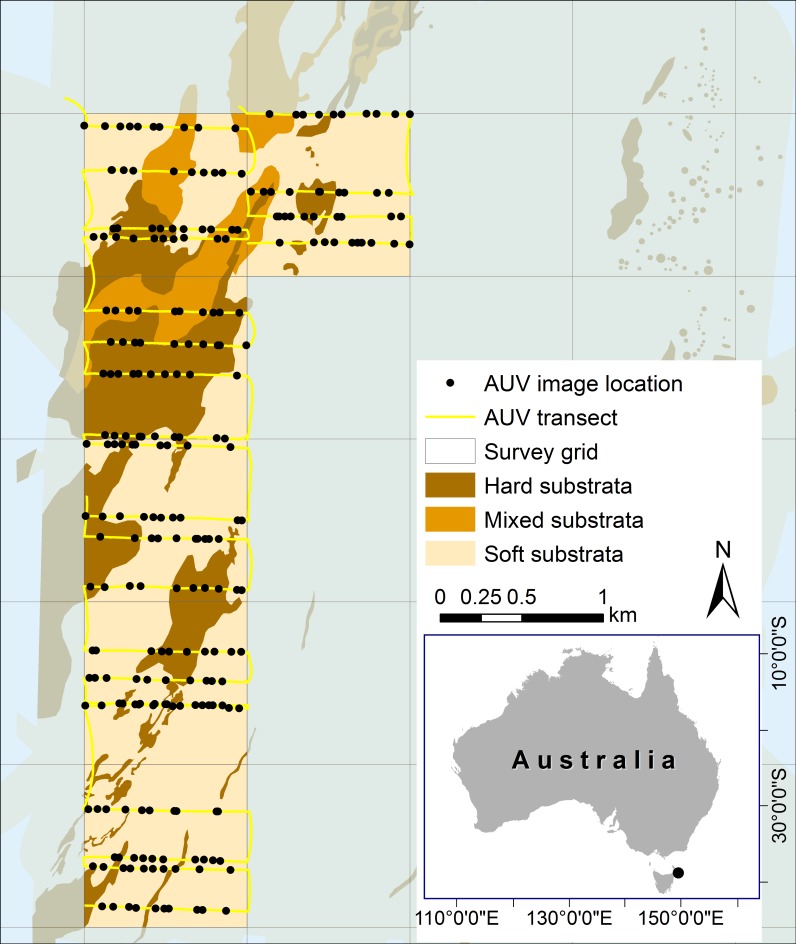
Fig 1. Study area map showing locations of autonomous underwater vehicle transects and images selected for interrogation of epibenthos cover.
Underlying data show the substrata classification across the broader region that was produced by Lawrence et al. [15]. Boxes show windows used to constrain sampling extent where a considerable proportion of reef habitat was mapped.

