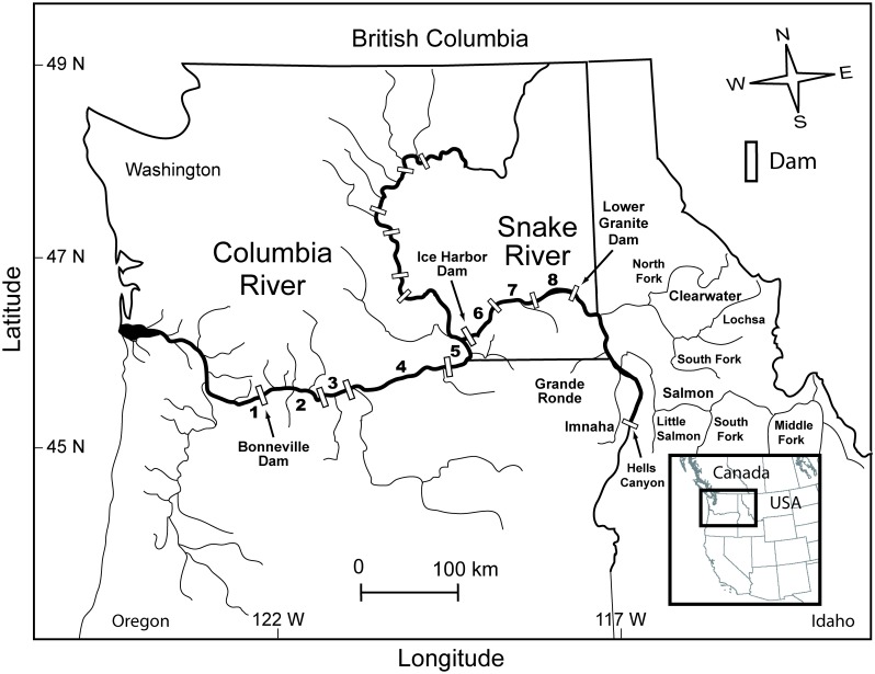
Fig 1. Map of the Columbia River—Snake River study area.
Black bold numbers indicate the eight reaches where RDST-tagged Chinook salmon and steelhead were monitored, including: (1) release to Bonneville Dam, (2) Bonneville Dam to The Dalles Dam, (3) The Dalles Dam to John Day Dam, (4) John Day Dam to McNary Dam, (5) McNary Dam to Ice Harbor Dam, (6) Ice Harbor Dam to Lower Monumental Dam, (7) Lower Monumental Dam to Little Goose Dam, and (8) Little Goose dam to Lower Granite Dam. Inset map shows the study area in the northwestern United States.

