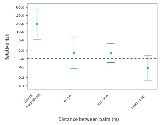
Figure 4.
Spatial clustering of cases by household distance, dengue serosurvey, Nîmes, France, 2015
Spatial clustering was measured as the relative risk (RR) of two dengue virus cases living within a distance range compared to two non-infected individuals living within that distance range; where the risk of a pair being in that distance range was calculated as number pairs within the range/ number pairs within the range or further apart. A distance of 0 m represents individuals living in the same building but different households.