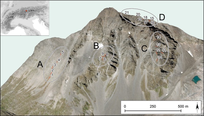
Figure 1.

Location of permanent plots on Mount Schrankogel. Plots are grouped in transects clustered into four topographic blocks: (A) uniformly shaped southwest slope, rich in scree; (B) rugged south‐facing ridge; (C) rugged south–southeast‐facing ridge; and (D) south‐facing, high‐elevation plots along the east ridge. Orthophotos (© Land Tirol) modified with ArcGIS 10.3. for Desktop, Esri Inc. Details of transects are shown in Supporting Information Fig. S1.
