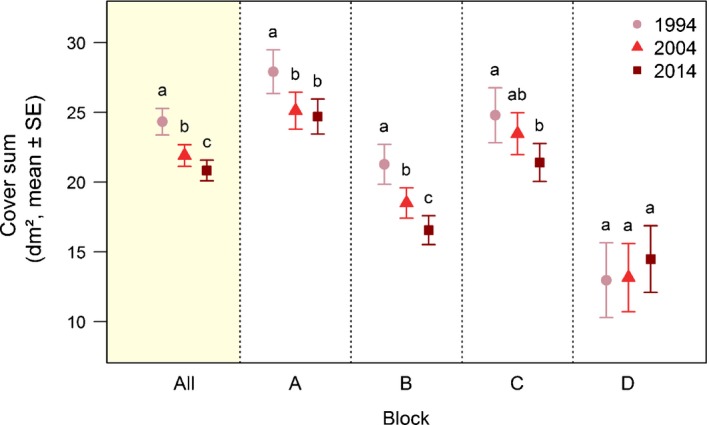
Figure 3.

Changes in vegetation cover of vascular plants on Mount Schrankogel. Mean ± SE of raw data of cover sum (Supporting Information Table S12) per plot on Mount Schrankogel in the survey years 1994, 2004 and 2014. Mean values over the entire study area (All, shaded) and for each block (A, B, C, D) are shown. For plot numbers per block, see Table S1. Different lowercase letters denote significant differences between the survey years within each block based on linear mixed‐effects models (Table S13).
