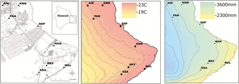
Fig. 1.
Maps of study sites in east Hawaii showing developed land, temperature, and precipitation. (A) Developed land, roads, and residential areas shown. The extent of the study area on the island of Hawaii is depicted in the upper right corner. Full site names are as follows: AIN, Ainako UH-Hilo; KMR, Keaukaha Miltary Reservation; PAN, Panaewa; SHP, W.H. Shipman property; NAN, Nanawale Forest Reserve; MAL, Malama Ki Forest Reserve; BRY, Bryson’s Cinder Cone (Pu’u Kali’u); KEA, Keauohana Forest Reserve. (B) Interpolated mean annual temperature in Celsius. Lines are 100 m elevational contours. (C) Interpolated annual cumulative rainfall. Lines are 500 mm rainfall isoclines; the line west of MAL is 2,500 mm.

