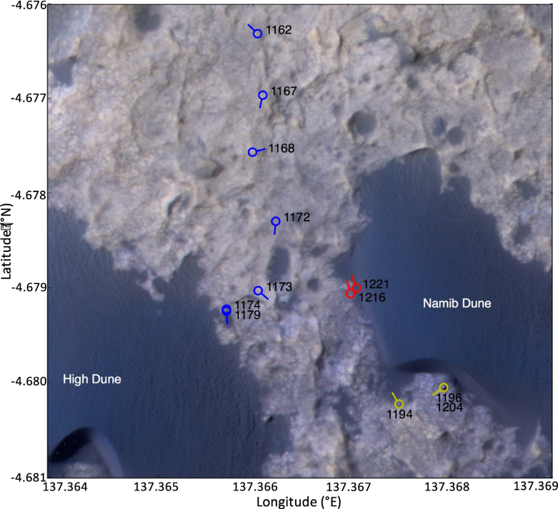
Fig. 1.
Rover location and sols during the Bagnold Dunes Campaign, relative to the location of the dunes investigated. Colored circles indicate the final rover position following a drive on the sol shown, while the line sticking out from the circle indicates the rover heading and hence the orientation of the working REMS wind sensor on Boom 2. The periods shown are (1) the Wind Characterization Investigation during the drive to High Dune (sols 1162 to 1179, shown in blue); (2) the Namib Dune Lee Investigation (sols 1194 to 1215, shown in yellow); and (3) the Namib Dune Side Investigation (sols 1216 to 1243, shown in red). (For interpretation of the references to color in this figure legend, the reader is referred to the web version of this article.)

