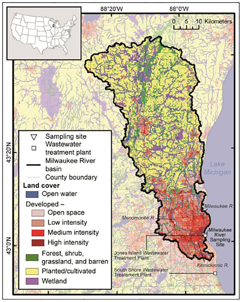
Figure 1: The Milwaukee River basin as the study site.
Land cover, the three main rivers draining to the estuary, and two wastewater treatment plants are labeled. Map is comprised of various spatial datasets: state boundaries (Instituto Nacional de Estadística Geografía e Informática et al., 2006), county boundaries (National Atlas of the United States, 2005), hydrography (U.S. Environmental Protection Agency and U.S. Geological Survey, 2005), land cover (Fry et al., 2011), and watershed boundaries (modified from Southeastern Wisconsin Regional Planning Commission, Environmental Division and GIS Division, 2005). DOI: https://doi.org/10.1525/elementa.301.f1

