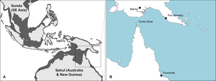
Fig 1. Map of Australasia and Southeast Asia.
a) 21,500 years ago during the last glacial maximum. The shaded regions represent what was dry land during the period. Note that Australia and PNG comprised a single continent (Sahul) and that most of Southeast Asia (Sunda) was linked by land bridges. b) Present day locations of significance for this study. The Torres Strait archipelago is comprised of some 274 individual islands scattered between New Guinea and mainland Australia.

