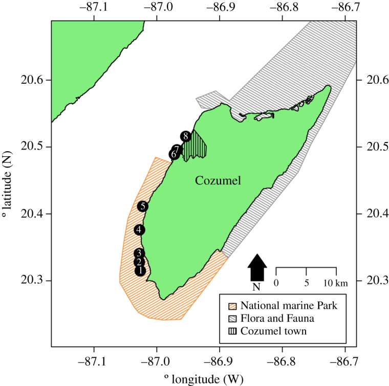
Figure 1.

Location of survey sites relative to Cozumel and the National Park and Flora and Fauna Protected Areas on Cozumel. Both shallow reefs and MCEs were surveyed at each site. Sites and their approximate distances from the main development in parenthesis were 1, Colombia (24.9 km); 2, Herradura (23.3 km); 3, Palancar Jardines (22.6 km); 4, Santa Rosa (18.2 km); 5, Punta Tunich (14.2 km); 6, Villa Blanca (4.1 km); 7, Transito Transbordador (3.3 km) and 8, Purgatorio (0.6 km). All distances from the main development were measured from the passenger ferry terminal in the centre of town following the edge of the reef crest in Google Earth. GPS locations for sites are given in electronic supplementary material, S1.
