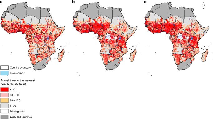
Fig. 2.
Travel time maps. Travel time to the nearest health facilities at 1 km spatial resolution in sub-Saharan Africa based on combined motorised transport and walking, adjusting for topography for a major general hospitals, b health centres and c dispensaries, clinics and health posts (lower-tier health facilities). The white patches are regions where health centre or dispensary maps were unavailable (the Congo, Equatorial Guinea, Guinea Bissau and two regions in the Democratic Republic of Congo (DRC))

