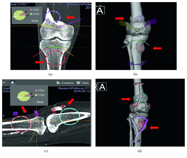
Figure 3.
Fusion of the datasets in the Stryker Navigation system. Preoperative images of surgical navigation planning on the navigation display for the CAS group (a, b) and CAS + PSI group (c, d). The original CT image datasets (CT01) were fused with a modified CT dataset (CT02) containing the locations of the tumor, resection planes, and PSI (red arrows) after simulated tumor resections in the MIMICS software. The planned resection planes could be marked with tools in the navigation system. Also, the CAD models (red arrows) of a tumor and PSI could be imported into the navigation system and positioned as planned in the MIMICS software. Reformatted coronal (a) and sagittal (c) images and the reconstructed 3D planning bone models (c, d) with a tumor, resection planes, and PSI illustrate the transfer of the virtual planning in MIMICS to the navigation system by the method of CAD to DICOM conversion and image fusion.

