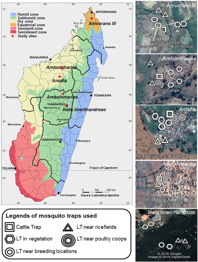
Figure 1.
Map of Madagascar showing location of collection sites and mosquito traps used. Adult trapping was undertaken in five ecologically diverse sites using both CDC light traps (LT) and Cattle (zebu) baited traps (CT) near rice fields, poultry coups and breeding locations to maximize the diversity of species collected. Anivorano III is located within commune Anivorano Nord, Ambomiharina is located within commune Tsaramandroso, Antafia is located within commune Bemokotra, Ambohimarina is located within commune Ankazobe and Ivato Imerimandroso is located within commune Ivato Aeroport. Bioclimatic map of Madagascar adapted from Brunhes et al.38 using Microsoft Powerpoint (2010) and Paint Net (v4.0.6). Google Earth Pro (version 7.3) was used for satellite imagery as follows: Source: «Ivato Imerimandroso» 18°47′21.71″S and 47°28′42.34″E. Google Earth Pro. June 17, 2018. October 17, 2018. Source: «Ambomiharina.» 18°19′38.86″S and 47°06′23.91″E. Google Earth Pro. Novembre 10, 2016. October 17, 2018, Source: «Antafia» 17°01′26.31″S and 46°45′41.97″E. Google Earth Pro. April 02, 2016. October 17, 2018, Source: «Ambomiharina» 16°21′38.92″S and 46°59′20.90″E. Google Earth Pro. July 24, 2016. October 17, 2018, Source: «Anivorano III» 12°45′31.11″S and 49°14′13.08″E. Google Earth Pro. July 31, 2016. October 17, 2018.

