
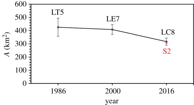
Figure 2.
Changes in Kenyan seagrass coverage 1986–2016 using Landsat (black) and S2 (red). Error bars were calculated by multiplying the % residual accuracy by total coverage to give a ± range.
Official websites use .gov
A
.gov website belongs to an official
government organization in the United States.
Secure .gov websites use HTTPS
A lock (
) or https:// means you've safely
connected to the .gov website. Share sensitive
information only on official, secure websites.
Changes in Kenyan seagrass coverage 1986–2016 using Landsat (black) and S2 (red). Error bars were calculated by multiplying the % residual accuracy by total coverage to give a ± range.