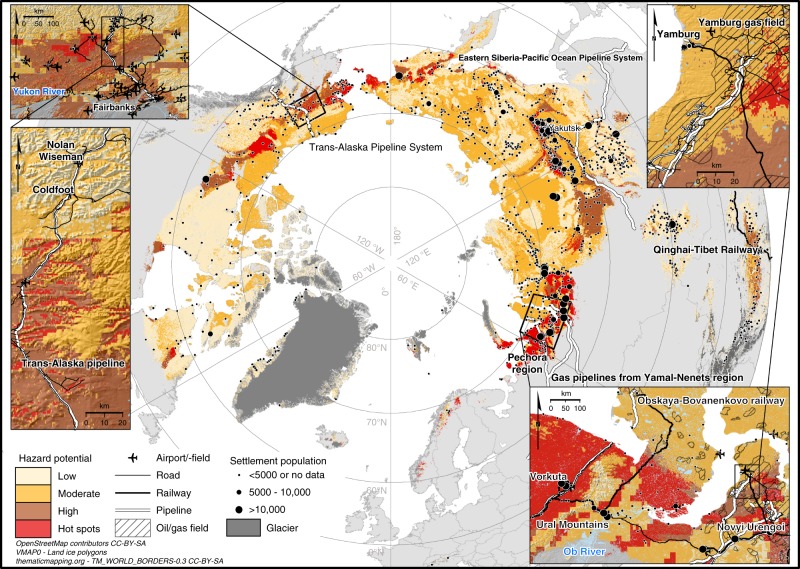
Fig. 3.
Pan-Arctic infrastructure hazard map with close-ups from central Alaska and northwestern parts of the Russian Arctic. A consensus of three geohazard indices (settlement index, risk zonation index, and analytic hierarchy process-based index) showing hazard potential by risk level (low–high) for infrastructure damage by the middle of the century (2041–2060). Hot spots indicate areas where all three indices showed high potential for infrastructure damage. Infrastructure other than settlements, the Qinghai–Tibet Railway, and major pipeline systems are shown only in the close-ups. OpenStreetMap data extracts47,50 are licensed under CC BY-SA 2.0 (https://creativecommons.org/licenses/by-sa/2.0/) and Open Database License v1.0 (http://opendatacommons.org/licenses/odbl/1.0/). World Borders dataset is from http://thematicmapping.org/downloads/world_borders.php and licensed under CC BY-SA 3.0 (https://creativecommons.org/licenses/by-sa/3.0/)

