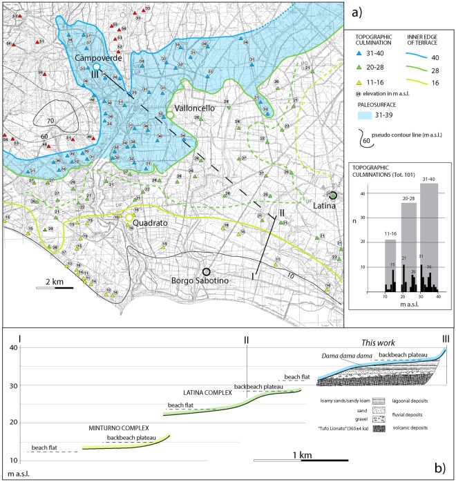
Figure 2.
(a) Geomorphologic map and statistics. Three paleosurfaces ranging 11–16, 20–28, and 31–40 m a.s.l., are depicted. The topographic culminations identified in the IMG 1:25.000 maps are reported with triangles of different colors on the 1:10.000 topographic base by Regione Lazio (http://dati.lazio.it/catalog/it/dataset/carta-tecnica-regionale-1991), available under Creative Commons Attribution License (https://creativecommons.org/licens/by/4.0/). Each color is associated with an elevation range defining a paleosurface which, in turn, is established based on the statistical analysis. See text for further explanation. (b) Cross-section showing the three marine terraces recognized in this area: the lower Latina and Minturno complexes (description of the associated deposits by17 is provided in the text), and the higher Campoverde complex recognized in this study.

