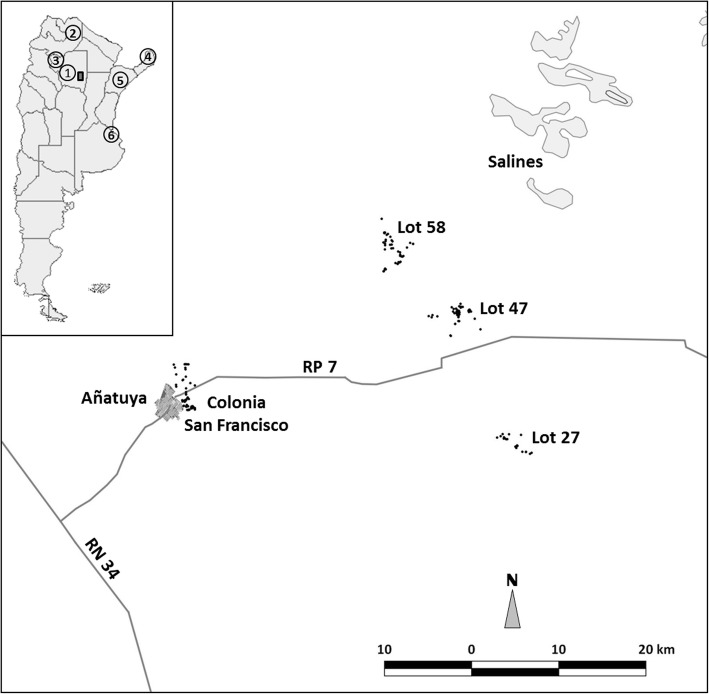
Fig. 1.
Map of the study area, Añatuya, Santiago del Estero, Argentina. Each point represents the individual georeferenced houses that were included in the study. Key: 1, Province of Santiago del Estero; 2, Province of Salta; 3, Province of Tucumán; 4, Province of Misiones; 5, Province of Corrientes; 6, City of Buenos Aires. The map was created using GvSig 1.11 software (Asociación gvSIG, 2017)

