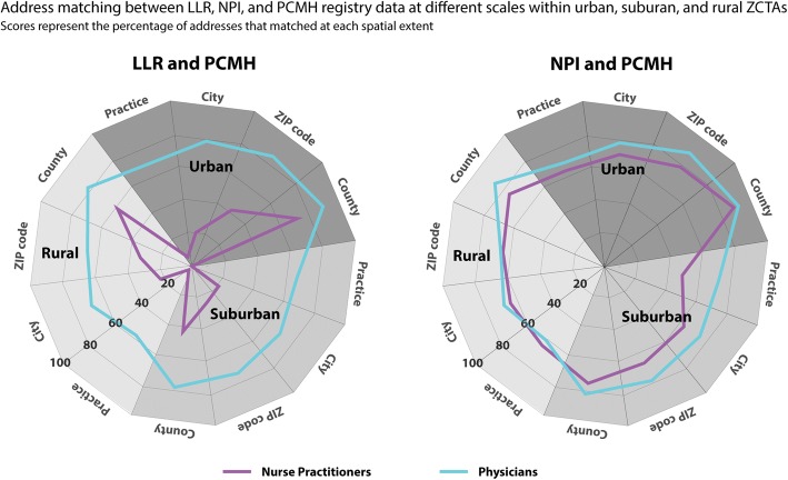
Fig. 1.
Radar graphs showing the registry address concordance for all providers at the practice-level, city, ZIP code, and county-level spatial extent across urban, suburban, and rural areas. Scores represent the percentage of all matching address files (e.g., 0 = 0% of addresses matched, 100 = 100% of addresses matched)

