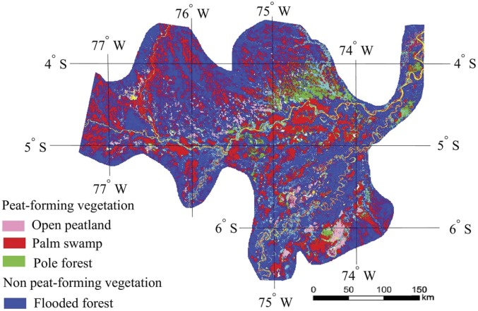
Fig. 1.
Distribution of peat-forming and non-peat-forming vegetation in the PMFB at the resolution of 90 × 90 m (13). The map was resized to 1.69 × 1.69 km. Colors represent vegetation types: open peatland (pink), PS (red), PF (green), and FF (dark blue). Yellow represents open water, and light blue represents other. See figures 1 and 4 of ref. 13 for the original map.

