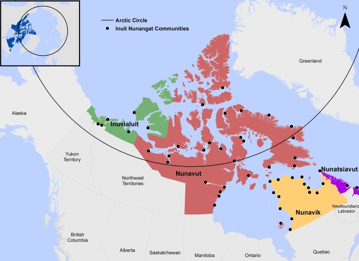
Fig 2. Inuit Nunangat.
Encompassing roughly 4 million km2, the Inuit region of the Canadian Arctic–known as Inuit Nunangat–represents 35% of Canada’s landmass and over 50% of coastline [11,12]. Basemap shapefiles are modified and republished from Government of Canada under a CC BY license, with permission from Natural Resources Canada and Crown-Indigenous Relations, original copyright 2018. Contains information licensed under the Open Government License–Canada [11,12].

