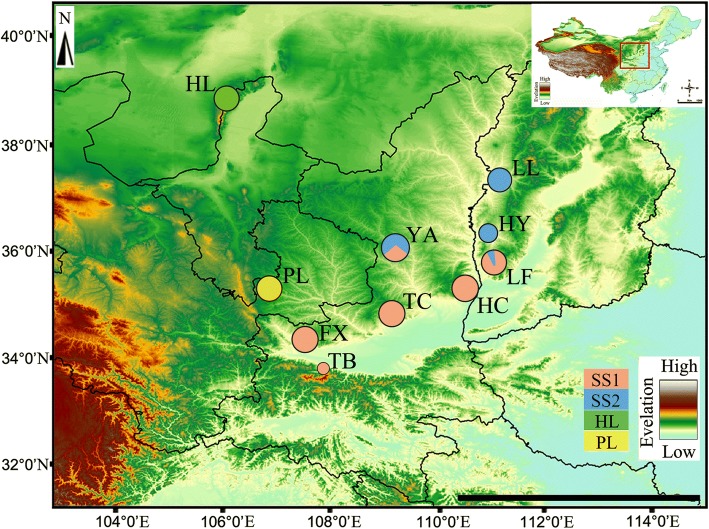
Fig. 1.
The geographic distribution of S. yangi species sampled in this study. Detailed information on the locations population codes are presented in Table 1. Pie charts for each population correspond to the proportion of each genetic cluster in the population. Figure generated in ArcGIS 10 (Environmental Systems Research Institute). Size of circles indicate sample size. SS: Group in Shaanxi and Shanxi province. HL: Population in Ningxia Hui Nationality Autonomous Region. PL: Population in Gansu province

