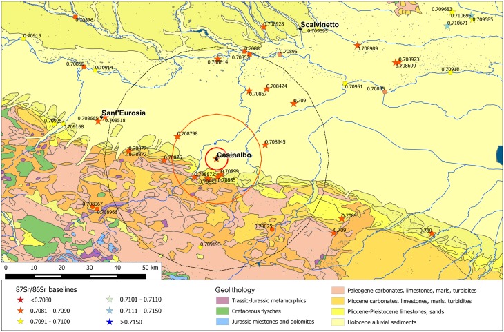
Fig 7. Casinalbo with the buffer zones and the available BASr baselines.
Stars represent the baselines obtained from vegetal/faunal samples, circles on mineral waters, pentagons on Po river waters, squares on tributary river waters. The map is constructed by using public domain wms data downloadable from http://wms.pcn.minambiente.it/ogc?map=/ms_ogc/WMS_v1.3/Vettoriali/Carta_geolitologica.map under a CC BY license, with permission from Geoportale Nazionale and plotting data from S1 Table.

