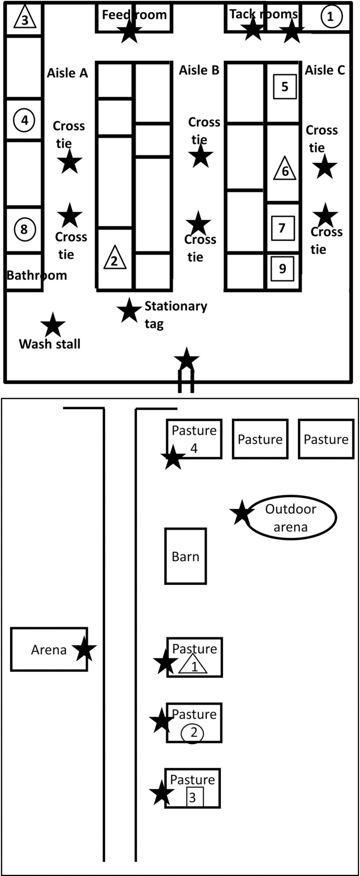
Fig 1.

Map of the barn (top panel) and facility (bottom panel). The maps are not drawn to scale. With the exception of the barn and the arena, all the locations indicated on the facility map were outdoors. Horses are represented by the numbers in the stall. The shape surrounding the numbers signifies the pasture in which the horse was turned out. The triangle represents pasture 1, the circle represents pasture 2, and the square represents pasture 3. The barn was separated into aisles. The horses were led through the aisles to the barn door in order to exit the barn. The horses were turned out in pastures 1–3, except for on the weekend when at least one horse was moved to pasture 4. Tag locations are indicated with a black star.
