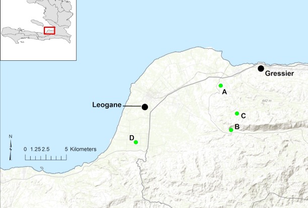
Fig 1. Map of schools enrolled in the study (green dots).
Major towns in region are Leogane and Gressier (black dots) plotted over topography. National Route 2, the main highway through the area is identified with a bolded line and smaller roads appear lighter (gray). Base map data from ESRI Online, GIS Use Community and others.

