
Fig 4. Landsat images, land cover (canga, forests and lakes) and land use (N4-N5, S11D and SL mines and pasturelands) maps from 1973, 1984, 2001 and 2016 in the Carajás Mineral Province.
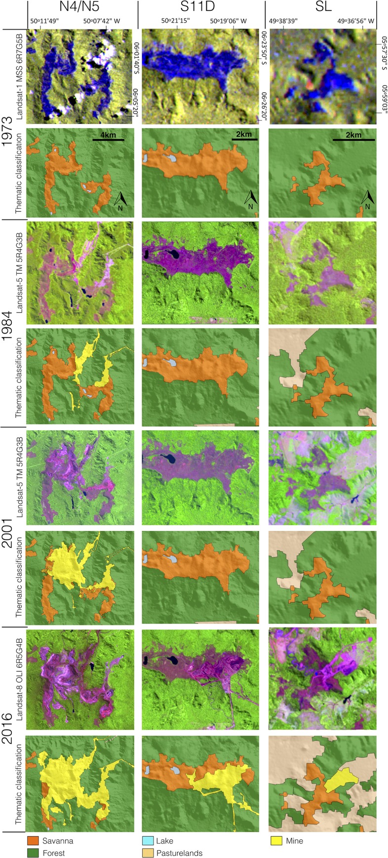
See location of the mines in Fig 1. The digital elevation model (SRTM, 1 arc-second) and Landsat images were obtained from USGS Earth Explorer (https://earthexplorer.usgs.gov). All other layers were produced by the authors and are copyright-free.