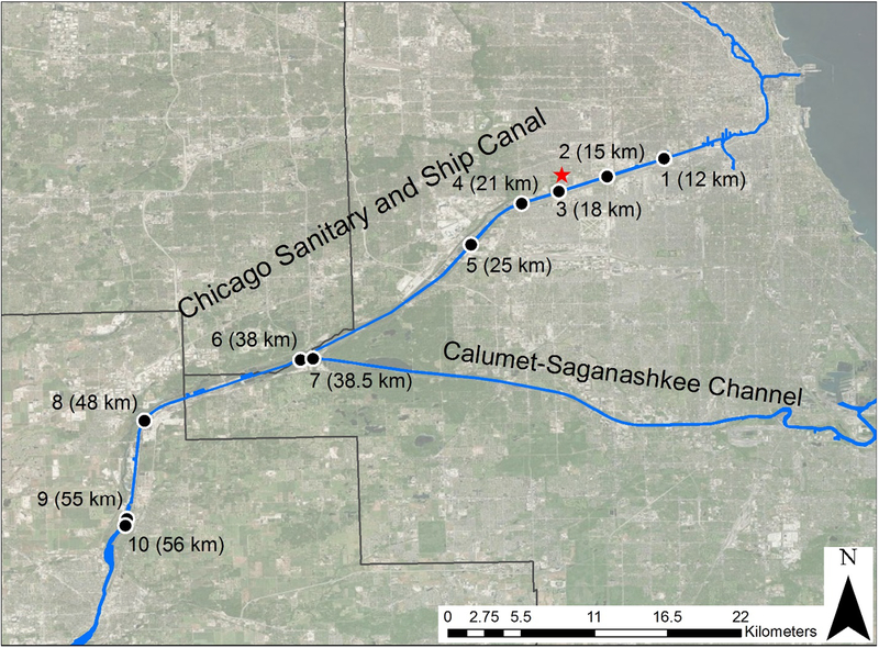
Figure 1:
Map of the sampling sites on the Chicago Sanitary and Ship Canal (CSSC) in Chicago, Illinois. Sampling sites are labeled with a black dot with their corresponding site number and distance (in river km) from the start of the Chicago River at Lake Michigan. Latitudes and longitudes for each site are given in Table 1. The red star is the Stickney water reclamation plant. The black straight lines represent the county borders; the largest one is Cook County

