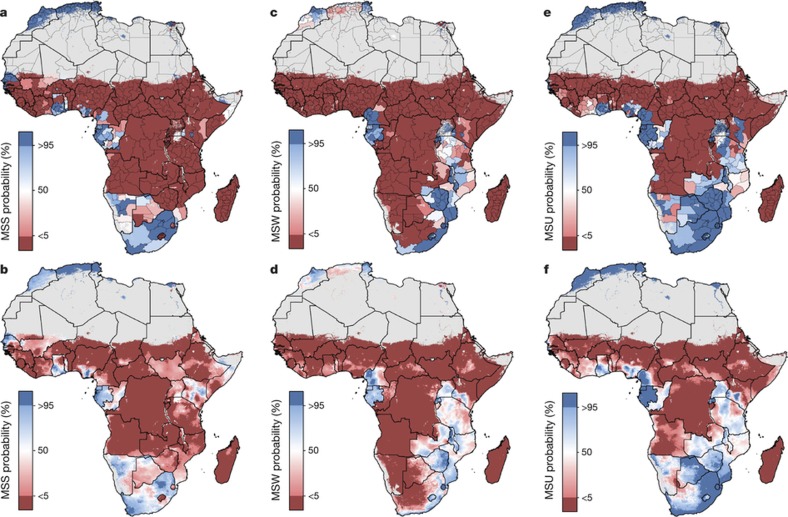
Figure 3. Probability that the WHO GNT has been achieved in 2015 at the first administrative subdivision and 5 × 5-km pixel level for stunting, wasting and underweight.
a–f, Probability of WHO GNT achievement in 2015 at the first administrative subdivision and 5 × 5-km level for moderate and severe stunting (a, b), moderate and severe wasting (c, d) and moderate and severe underweight (e, f). The probability that dark-blue pixels have met the WHO GNT in 2015 is greater than 95%, and less than 5% for dark-red pixels. Estimates for 2015 at the 5 × 5-km level have been calculated using population-weighting based on the population of children under five and probabilities that the WHO GNT were met in 2015. Maps reflect administrative boundaries, land cover, lakes and population; pixels with fewer than ten people per 1 × 1 km and classified as ‘barren or sparsely vegetated’ are coloured in grey44,45,46,47,48,49.

